Using high-resolution acoustic data to explore fish interactions with offshore platforms
Study provides evidence that both schooling and non-schooling fish associate with oil and gas platforms in the North Sea over long distances
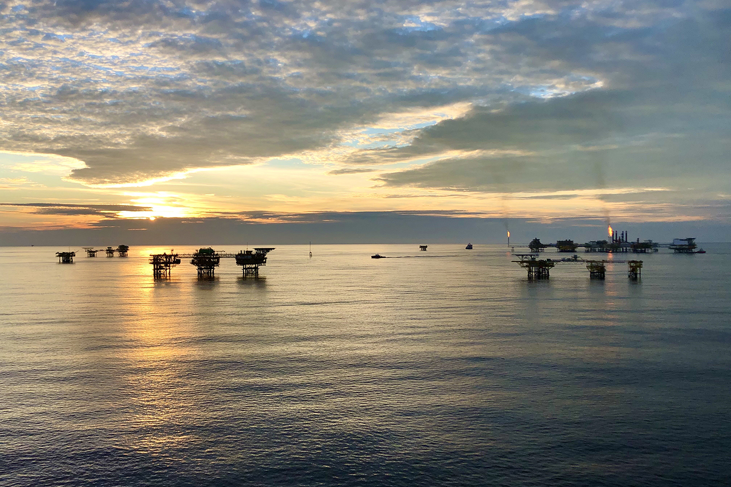
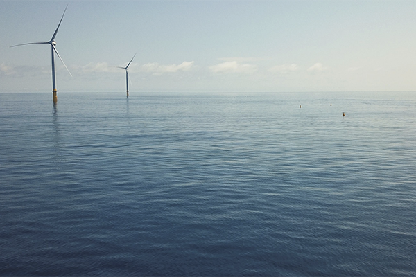
Fish associate with man-made marine structures (MMS), such as oil and gas platforms. There are currently thousands of these platforms currently installed globally, following the expansion of offshore fossil fuel exploration in the mid-20th century, and the expansion of offshore renewable energy could add many more MMS in the coming years. In some regions like the Gulf of Mexico, oil platforms host such consistently high fish numbers that they are targeted by both commercial and recreational fishermen. Furthermore, a study of the oil platforms off California found them to be the most productive waters per unit area of seafloor of any area for which similar estimates exist.
Much of the global oil and gas infrastructure is now nearing the end of its operational life and will soon need decommissioning, meaning managers will be required to decide on the optimal approach to removing much of what was installed. However, in some areas, such as the North Sea, current legislation requires the complete removal of all installed structures, although derogations can be made under certain conditions on a case-by-case basis. However, there is a lack of unequivocal evidence regarding the ecological impact of these structures, and the likely consequences of their removal.
Fish distributions around oil and gas platforms and other infrastructure in the North Sea have not been studied extensively. There is a need for larger-scale, but high-resolution, surveys of fish distributions around multiple platforms throughout the North Sea. Such surveys can be difficult and expensive over large areas, but fisheries acoustics provide a means to monitor fish at very fine resolution, rapidly and effectively. Data collection, processing and analysis techniques are well-refined and have been used extensively to study fish abundance, biomass and distribution at the ecosystem scale.
This article – summarized from the original publication (Lawrence, J.M. et al. 2024. Elevated fish densities extend kilometers from oil and gas platforms. PLoS ONE 19(5): e0302738) – presents the results of research to analyze the relationship between fish density and oil and gas MMS for schooling and non-schooling fish.

Study setup
We used fisheries acoustics to investigate the distributions of fish around oil and gas platforms and associated infrastructure throughout the North Sea, searching for relationships between fish and platform areal densities using high-resolution fisheries acoustic data. Data were collected in the waters surrounding the vessel exclusions zones around 16 oil and gas platforms in the North Sea, and throughout the wider area. We estimated densities of schooling fish using echo integration and densities of non-schooling fish using echo counting.
For detailed information on the study setup, data acquisition, equipment used, and analyses of data, refer to the original publication.
Results and discussion
We found strong evidence that fish, both schooling and non-schooling, associate with oil and gas platforms in the North Sea. The densities of non-schooling fish were found to be higher, and fish schools were more likely to be encountered, in areas of high platform density. Furthermore, the evidence suggests that these associations exist over long ranges, up to the order of several kilometers, extending well beyond the 500 m safety zones in place around North Sea platforms.

Previous work in the North Sea and elsewhere found similar elevated densities of fish in close proximity to platforms, but reported that fish numbers dropped rapidly as distance from the platform increased beyond just tens to hundreds of meters. However, here the horizontal range of influence ranged between 0.8 and 23.2 km. This wide range emphasizes how variable this relationship is between individual platforms.
This new evidence is timely and relevant in the context of the upcoming challenges associated with the decommissioning of a large portion of the North Sea’s oil and gas infrastructure as it reaches the end of its operational lifespan. Of particular importance is the evidence that the range of influence of many of these structures is significantly greater than their immediate physical footprint, and even the safety zones in place around them. While current legislative decommissioning requirements for platforms necessitate complete removal, there is a lack of evidence regarding the ecological impacts these structures, and their potential removal, may have on the ecosystem and fisheries.
Evidence that fish associate with these structures, especially across such large scales, highlights the possibility that there may be measurable benefit provided by these structures and that their complete removal may actually be detrimental to the environment and to the interests of relevant stakeholders. However, further work is needed to investigate the mechanistic causes of the relationships found in this work. The evidence in our study suggests that fish associating with these platforms are not always confined to the immediate proximity of the structure themselves.
Further work could also consider the vertical distributions of fish in the context of proximity to oil and gas platforms. Several cod species are found in midwater as well as near the seabed, but oil platforms provide hard substrate throughout the vertical extent of the water column, and may thus alter the vertical distributions of nearby fish, although evidence for this may be limited. It would be valuable to investigate the impacts of oil platforms on the vertical distribution of fish in more detail, particularly to consider these effects over a broader horizontal scale than has been previously, in light of the long-range influence of oil platforms on fish densities reported here.
The differences in fish densities associated with each seabed habitat are also difficult to interpret. More detailed work on this, involving drop-camera and/or grab sampling, and reconciliation with existing habitat maps, would allow the assigned seabed classes to be ground-truthed, defined, and validated.
More work is also needed to fully understand the causes of the inter-platform variability in the trends of fish density and distance from the platform. While the modeling results presented here demonstrate a general trend of fish density increasing with the local density of platforms, the inspection of the platform-by-platform data demonstrates strong variability. Differences in platform design and size, and the habitat (depth, substrate, and hydrodynamic conditions) in which a platform is located may determine the influence any given platform has on the local fish population. Focused studies of fish around platforms across the range of these variables will allow the determination of those factors that control the relationships described here.
It is also important to understand the influence of man-made structures on fish migratory and spawning behavior. The data used in this work were collected in late summer, outside of the periods of either migration or spawning in any of the most likely species to have made up the demersal fish assemblage encountered. However, the data collection period did overlap with the start of the autumn spawning period of North Sea herring, likely the main constituent of the fish schools detected here, which may have affected the strength of associations observed.

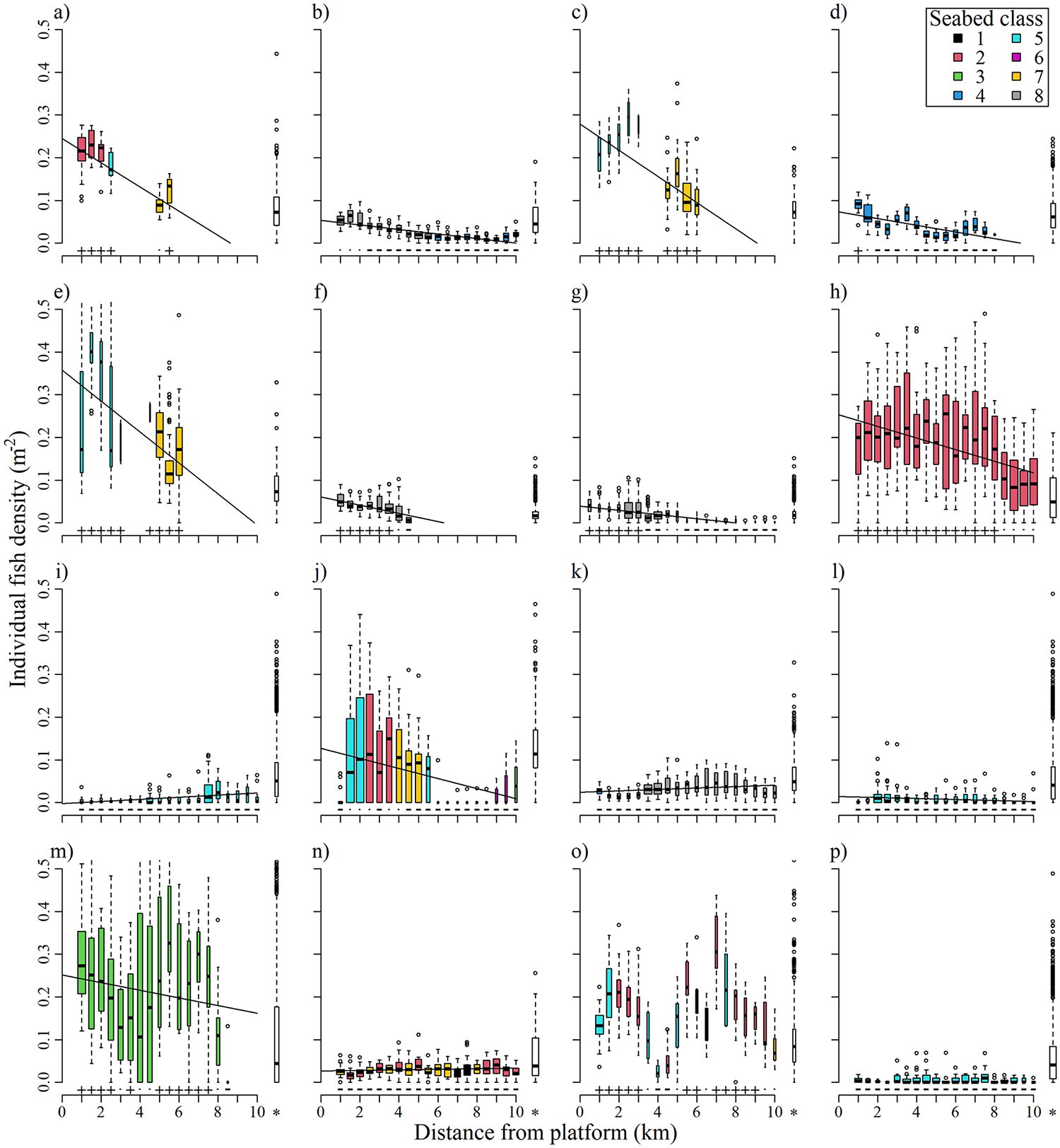
Plots showing the shape of fitted explanatory terms found to be significant (at α = 0.01) during the generalized additive modeling process. Boxes a-c are terms from the model of fish school presence/absence, showing the relationship with a) platform density, b) depth and c) sea surface temperature (SST), and d-f are terms from the model of non-schooling fish density, showing the relationship with d) platform density, e) depth and f) bottom water temperature. Adapted from the original.
An additional factor to be considered when investigating the influence of structures on fish densities and distributions is fish size, and whether the horizontal trends in fish density reported here are consistent across fish sizes, or if, for example, larger fish are more likely to associate with platforms than smaller fish. Trends may vary with seasonal changes in spawning and migratory behavior, which are themselves age/size dependent. More work is needed to investigate these potential effects, and better understand the influence platforms have on the life history of local fish populations.
Studies of spawning activity at oil platforms, and a better understanding of the demography of fish associating with platforms, would also contribute to addressing the key area of uncertainty remaining for managers who must decide the fate of these oil and gas platforms. This uncertainty is around whether the increased numbers of fish recorded at and in the vicinity of platforms is due to increased local production, or simply due to aggregation of the surrounding fish population. Elsewhere, similar platforms have been found to have the highest secondary production per unit area of seafloor of any measured system; the data presented here, and other datasets currently being collected, will allow progress to be made towards answering this key question.
Perspectives
Results provide evidence that both schooling and non-schooling fish associate with oil and gas platforms in the North Sea over long distances. Where previously fish densities were only thought to be elevated in very close proximity (less than a few hundred meters) to platforms, here they were often found to remain above baseline levels for several kilometers, well beyond the 500 m safety zones in place around active platforms. Uncertainty remains around whether these trends are due to aggregation of fish or increased local production and around the causes of the inter-platform variability seen in the observed trends, but this work presents the first suggestion that the ecological impact of these structures, particularly on fish populations, may be wider ranging that previously thought.
Now that you've reached the end of the article ...
… please consider supporting GSA’s mission to advance responsible seafood practices through education, advocacy and third-party assurances. The Advocate aims to document the evolution of responsible seafood practices and share the expansive knowledge of our vast network of contributors.
By becoming a Global Seafood Alliance member, you’re ensuring that all of the pre-competitive work we do through member benefits, resources and events can continue. Individual membership costs just $50 a year.
Not a GSA member? Join us.
Author
-

Corresponding author and Ph.D. candidate
The Lyell Centre, Heriot-Watt University, Edinburgh, Scotland, United Kingdom
Related Posts
Fisheries
Acoustic receiver promises a faster way to track fish
PNNL researchers have developed a new acoustic receiver that sends near-real-time fish tracking data to the digital cloud.
Aquafeeds
Acoustic feedback improves automated feeding systems for shrimp
Updating Auburn University’s standard feeding protocol for shrimp into an optimized version for timer-feeders, recognizing the role of acoustic feedback.
Fisheries
Can electronic tags fill knowledge gaps between offshore wind and fisheries?
A first-of-its-kind study will explore fish behavior in response to offshore wind turbines and construction activities in the Atlantic Ocean.
Responsibility
Could fish aggregation at ocean aquaculture structures expand wild populations and local fisheries?
Study provides recommendations on designing and co-managing aquaculture and ecosystem management to benefit fisheries and conservation objectives.